Survey Section | What We Do

    • Responsible for all the survey requirements of the Government of Seychelles
    • Regulates and facilitates survey activities within the Seychelles under the Laws of Seychelles CAP109


ONGOING PROJECTS OF THE SURVEY SECTION OF THE MLUH


Cad – Reform 


    • Clean Cadastral layer – no overlaps, double beacons etc… 
    • Creation and maintenance of a Geodatabase
    • Creation of automation modules for checks and procedures


GPS Base station 

    • Real time diferential GPS 
    • Improved positioning solutions


Outsourcing 

    • Cadastral 
    • Relocation


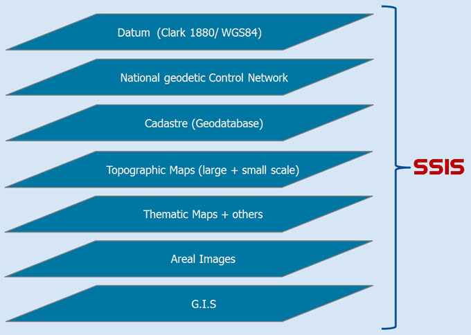
Seychelles Spatial Information System (SSIS)

Our Long Term Vision & Target is...

“to see a country with a good and reliable survey infrastructure, up to date digital topographical map and cadastre and to provide direct and secure access to survey data online” 

Our Mission is...

“to support the equitable distribution of land and be committed to providing the business community and the public at large with integrated services of the highest standards through the undertaking of dedicated surveying related activities within prescribed jurisdiction”

The Madate of the Survey Section is...